Ruthin Forest Resource Plan
Overview
Natural Resources Wales (NRW) is responsible for the sustainable management of publicly own woodlands and forests of Wales known as the Welsh Government Woodland Estate. As well as providing a valuable timber resource, they are managed for the benefit and well-being of people and local communities who visit them, as well as people who depend on them for their livelihood. This responsibility includes safeguarding their long-term resilience in relation to the nature and climate emergencies, so that future generations will also be able to enjoy the benefits that they provide. Every ten years NRW reviews the long-term management plans for each forest area known as a Forest Resource Plan.
Ruthin Location & Setting
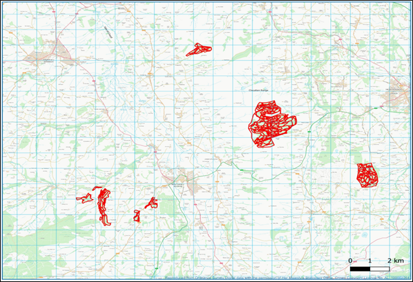
Ruthin Forest Resource Plan (FRP) which includes eight forest blocks has a total area of 749 ha. Overall, the various forest blocks are predominantly coniferous, though some individual blocks contain high proportions of broadleaves. The blocks are spread across and area of roughly 100 km2 around the towns of Mold, Ruthin and Denbigh, with the three easternmost blocks – Coed Moel Famau, Nercwys and Llangwyfan – lying within the Clwydian Range and Dee Valley Area of Outstanding Natural Beauty (AONB). All the blocks apart from Llangwyfan lie within 4 km of the A494 road, which runs north-east through the plan area. Moel Famau is the largest block at 428 ha, which lies on the upland spine of the Clwydian Range roughly halfway between Ruthin and Mold.
The surrounding habitat of the Ruthin FRP blocks consists of enclosed grazed farmland, open moorland and commercial conifer forest blocks, which are generally located on the higher elevations, with mixed conifer/broadleaved woodlands on the lower slopes and along riversides. The large Clocaenog forest, also managed by NRW, lies to the west of Ruthin FRP. All the Ruthin forest blocks are dedicated for open access on foot under the CRoW Act and also allows access for horse and cycles on a permissive basis. There is a network of Public Rights of Ways that connects the blocks to the wider landscape, with the Offa’s Dyke long distance trail running along the edge of the Coed Moel Famau and Llangwyfan blocks.
Ruthin Forest falls into six different river catchments as defined by the Water Framework Directive. All of these catchments fall within the larger Clwyd and Dee catchments, and of the six, two hold a ‘Good’ overall status, two a ‘Moderate’ overall status and two a ‘Poor’ overall status
Opportunities and Priorities
- Removal of larch and diversify the forest species composition to increase resilience to pests and diseases whilst building a robust forest for future generations.
- Continue to maintain a sustainable supply of timber production through the design of felling and restock species choice.
- Increase of successional, riparian and broadleaved woodland areas for the improvement of habitat resilience and landscape scale habitat linkages.
- Identify and protect important heritage features, including the historic natural environment.
- Continue to identify and restore ancient woodland site features and areas of conservation interest.
- Maintain and improve visitors experience by providing a safe and enjoyable diverse environment.
This document helps to explain the categories shown on the maps below:
Coed Moel Famau
Llangwyfan
Nercwys
Rhyd y Gaseg and Pool Parc
Bontuchel and Trer Parc
Summary of the main changes that will occur in the forest
- Reduction of larch as a dominant species from 11% to 2% which will increase forest resilience.
- Reduction of Sitka spruce cover from 23% to 20% by the end of the FRP period.
- The restoration of ancient woodland sites (58ha) by the removal of conifer and the creation of native broadleaf habitat.
- An increase in broadleaf woodland habitat from 25% to 31% of the forest area.
- Increase of other habitat types such open and successional woodland from 18% to 21% by the end of the FRP period.
A drop-in session will be held at Llanbedr Dyffryn Clwyd Village Hall, Llanbedr DC, LL15 1UP, between 3.00pm - 7.15pm on Monday 27th March 2023 to allow members of the public the opportunity to discuss the Ruthin Forest Resource Plan in person with NRW forest planners.
Why your views matter
We would like to know your opinion and views on the new plans for Ruthin forest so it can help us improve the long-term management of the forest
What happens next
A summary of the consultation responses and outcomes will be available on this website 4 to 6 weeks after the closing date.
Areas
- Aber Valley
- Aber-craf
- Aberaeron
- Aberaman North
- Aberaman South
- Aberavon
- Aberbargoed
- Abercarn
- Abercynon
- Aberdare East
- Aberdare West/Llwydcoed
- Aberdaron
- Aberdovey
- Aberdulais
- Abererch
- Abergele Pensarn
- Abergwili
- Aberkenfig
- Abermaw
- Aberporth
- Abersoch
- Abersychan
- Aberteifi/Cardigan-Mwldan
- Aberteifi/Cardigan-Rhyd-y-Fuwch
- Aberteifi/Cardigan-Teifi
- Abertillery
- Aberystwyth Bronglais
- Aberystwyth Canol/Central
- Aberystwyth Gogledd/North
- Aberystwyth Penparcau
- Aberystwyth Rheidol
- Acton
- Adamsdown
- Aethwy
- Allt-wen
- Allt-yr-yn
- Alway
- Ammanford
- Amroth
- Argoed
- Arllechwedd
- Aston
- Badminton
- Bagillt East
- Bagillt West
- Baglan
- Bala
- Banwy
- Bargoed
- Baruc
- Beaufort
- Beddau
- Bedlinog
- Bedwas, Trethomas and Machen
- Beechwood
- Beguildy
- Berriew
- Bethel
- Bettws
- Betws
- Betws yn Rhos
- Betws-y-Coed
- Beulah
- Bigyn
- Bishopston
- Blackmill
- Blackwood
- Blaen Hafren
- Blaenavon
- Blaengarw
- Blaengwrach
- Blaina
- Bodelwyddan
- Bontnewydd
- Bonymaen
- Borras Park
- Borth
- Botwnnog
- Bowydd and Rhiw
- Brackla
- Brithdir and Llanfachreth/Ganllwyd/Llanelltyd
- Briton Ferry East
- Briton Ferry West
- Bro Aberffraw
- Bro Rhosyr
- Bronington
- Bronllys
- Broughton North East
- Broughton South
- Brymbo
- Bryn
- Bryn and Cwmavon
- Bryn Cefn
- Bryn-coch North
- Bryn-coch South
- Bryn-crug/Llanfihangel
- Bryncethin
- Bryncoch
- Brynford
- Brynmawr
- Brynna
- Bryntirion, Laleston and Merthyr Mawr
- Brynwern
- Brynyffynnon
- Buckley Bistre East
- Buckley Bistre West
- Buckley Mountain
- Buckley Pentrobin
- Builth
- Burry Port
- Burton
- Butetown
- Buttrills
- Bwlch
- Bynea
- Cadnant
- Cadoc
- Cadoxton
- Caerau
- Caergwrle
- Caergybi
- Caerhun
- Caerleon
- Caersws
- Caerwent
- Caerwys
- Caldicot Castle
- Camrose
- Canolbarth Môn
- Canton
- Cantref
- Capel Dewi
- Capelulo
- Carew
- Carmarthen Town North
- Carmarthen Town South
- Carmarthen Town West
- Cartrefle
- Castle
- Castleland
- Cathays
- Cefn
- Cefn Cribwr
- Cefn Fforest
- Cefn Glas
- Cenarth
- Ceulanamaesmawr
- Chirk North
- Chirk South
- Church Village
- Churchstoke
- Cilcain
- Cilfynydd
- Cilgerran
- Ciliau Aeron
- Cilycwm
- Cimla
- Clydach
- Clydau
- Clynnog
- Cockett
- Coed Eva
- Coedffranc Central
- Coedffranc North
- Coedffranc West
- Coedpoeth
- Coity
- Colwyn
- Connah's Quay Central
- Connah's Quay Golftyn
- Connah's Quay South
- Connah's Quay Wepre
- Conwy
- Cornelly
- Cornerswell
- Corris/Mawddwy
- Corwen
- Court
- Cowbridge
- Coychurch Lower
- Craig-y-Don
- Creigiau/St. Fagans
- Criccieth
- Crickhowell
- Croesonen
- Croesyceiliog North
- Croesyceiliog South
- Crosskeys
- Crucorney
- Crumlin
- Crwst
- Crymych
- Crynant
- Cwm
- Cwm Clydach
- Cwm-twrch
- Cwm-y-Glo
- Cwmbach
- Cwmbwrla
- Cwmllynfell
- Cwmtillery
- Cwmyniscoy
- Cyfarthfa
- Cymmer
- Cyncoed
- Cynwyl Elfed
- Cynwyl Gaeo
- Dafen
- Darren Valley
- Deganwy
- Deiniol
- Deiniolen
- Denbigh Central
- Denbigh Lower
- Denbigh Upper/Henllan
- Devauden
- Dewi
- Dewstow
- Diffwys and Maenofferen
- Dinas Cross
- Dinas Powys
- Disserth and Trecoed
- Dixton with Osbaston
- Dolbenmaen
- Dolforwyn
- Dolgellau North
- Dolgellau South
- Dowlais
- Drybridge
- Dunvant
- Dyfan
- Dyffryn
- Dyffryn Ardudwy
- Dyffryn Ceiriog/Ceiriog Valley
- Dyserth
- East Williamston
- Ebbw Vale North
- Ebbw Vale South
- Efail-newydd/Buan
- Efenechtyd
- Eglwysbach
- Eirias
- Elli
- Ely
- Erddig
- Esclusham
- Ewloe
- Faenor
- Fairwater
- Fairwood
- Felin-fâch
- Felindre
- Felinfoel
- Ferndale
- Ffynnongroyw
- Fishguard North East
- Fishguard North West
- Flint Castle
- Flint Coleshill
- Flint Oakenholt
- Flint Trelawny
- Forden
- Gabalfa
- Gaer
- Garden Village
- Garnant
- Garth
- Gele
- Georgetown
- Gerlan
- Gibbonsdown
- Gilfach
- Gilfach Goch
- Glanamman
- Glantwymyn
- Glanymor
- Glasbury
- Glyder
- Glyn
- Glyncoch
- Glyncorrwg
- Glynneath
- Godre'r graig
- Goetre Fawr
- Gogarth
- Goodwick
- Gorseinon
- Gorslas
- Gower
- Gowerton
- Graig
- Grangetown
- Green Lane
- Greenfield
- Greenmeadow
- Gresford East and West
- Groeslon
- Grofield
- Gronant
- Grosvenor
- Guilsfield
- Gurnos
- Gwaun-Cae-Gurwen
- Gwenfro
- Gwernaffield
- Gwernyfed
- Gwernymynydd
- Gwersyllt East and South
- Gwersyllt North
- Gwersyllt West
- Gwynfi
- Halkyn
- Harlech
- Haverfordwest: Castle
- Haverfordwest: Garth
- Haverfordwest: Portfield
- Haverfordwest: Prendergast
- Haverfordwest: Priory
- Hawarden
- Hawthorn
- Hay
- Heath
- Hendre
- Hendy
- Hengoed
- Hermitage
- Higher Kinnerton
- Hirael
- Hirwaun
- Holt
- Holywell Central
- Holywell East
- Holywell West
- Hope
- Hundleton
- Illtyd
- Johnston
- Johnstown
- Kerry
- Kidwelly
- Kilgetty/Begelly
- Killay North
- Killay South
- Kingsbridge
- Kinmel Bay
- Knighton
- Lampeter
- Lampeter Velfrey
- Lamphey
- Landore
- Langstone
- Lansdown
- Larkfield
- Laugharne Township
- Leeswood
- Letterston
- Lisvane
- Liswerry
- Litchard
- Little Acton
- Llanaelhaearn
- Llanafanfawr
- Llanarmon-yn-Ial/Llandegla
- Llanarth
- Llanbadarn Fawr
- Llanbadarn Fawr-Padarn
- Llanbadarn Fawr-Sulien
- Llanbadoc
- Llanbedr
- Llanbedr Dyffryn Clwyd/Llangynhafal
- Llanbedrog
- Llanberis
- Llanboidy
- Llanbradach
- Llanbrynmair
- Llandaff
- Llandaff North
- Llanddarog
- Llandderfel
- Llanddulas
- Llandeilo
- Llandinam
- Llandough
- Llandovery
- Llandow/Ewenny
- Llandrillo
- Llandrillo yn Rhos
- Llandrindod East/Llandrindod West
- Llandrindod North
- Llandrindod South
- Llandrinio
- Llandybie
- Llandyfriog
- Llandyrnog
- Llandysilio
- Llandysilio-gogo
- Llandysul Town
- Llanegwad
- Llanelly Hill
- Llanelwedd
- Llanengan
- Llanfair Caereinion
- Llanfair Dyffryn Clwyd/Gwyddelwern
- Llanfarian
- Llanfihangel
- Llanfihangel Aberbythych
- Llanfihangel Ystrad
- Llanfihangel-ar-Arth
- Llanfoist Fawr
- Llanfyllin
- Llanfynydd
- Llangadog
- Llangattock
- Llangeinor
- Llangeitho
- Llangeler
- Llangelynin
- Llangennech
- Llangernyw
- Llangewydd and Brynhyfryd
- Llangollen
- Llangollen Rural
- Llangors
- Llangunllo
- Llangunnor
- Llangwm
- Llangybi
- Llangybi Fawr
- Llangyfelach
- Llangyndeyrn
- Llangynidr
- Llangynwyd
- Llanharan
- Llanharry
- Llanhilleth
- Llanidloes
- Llanishen
- Llanllyfni
- Llannon
- Llanover
- Llanrhaeadr-ym-Mochnant/Llansilin
- Llanrhaeadr-yng-Nghinmeirch
- Llanrhian
- Llanrhystyd
- Llanrug
- Llanrumney
- Llansamlet
- Llansanffraid
- Llansannan
- Llansantffraed
- Llansantffraid
- Llansteffan
- Llantarnam
- Llantilio Crossenny
- Llantrisant Town
- Llantwit Fardre
- Llantwit Major
- Llanuwchllyn
- Llanwddyn
- Llanwenarth Ultra
- Llanwenog
- Llanwern
- Llanwnda
- Llanwrtyd Wells
- Llanybydder
- Llanyrafon East and Ponthir
- Llanyrafon West
- Llanyre
- Llanystumdwy
- Llay
- Lledrod
- Lliedi
- Llifôn
- Lligwy
- Llwyn-y-pia
- Llwynhendy
- Llysfaen
- Lower Brynamman
- Lower Loughor
- Machynlleth
- Maenclochog
- Maerdy
- Maescar/Llywel
- Maesteg East
- Maesteg West
- Maesycwmmer
- Maesydre
- Malpas
- Mancot
- Manorbier
- Manordeilo and Salem
- Marchog
- Marchwiel
- Mardy
- Marford and Hoseley
- Margam
- Marl
- Marshfield
- Martletwy
- Mawr
- Mayals
- Meifod
- Melindwr
- Menai (Bangor)
- Menai (Caernarfon)
- Merlin's Bridge
- Merthyr Vale
- Milford: Central
- Milford: East
- Milford: Hakin
- Milford: Hubberston
- Milford: North
- Milford: West
- Mill
- Minera
- Mitchel Troy
- Mochdre
- Mold Broncoed
- Mold East
- Mold South
- Mold West
- Montgomery
- Morfa
- Morfa Nefyn
- Morgan Jones
- Moriah
- Morriston
- Mostyn
- Mountain Ash East
- Mountain Ash West
- Mynyddbach
- Nant-y-moel
- Nantmel
- Nantyglo
- Narberth
- Narberth Rural
- Neath East
- Neath North
- Neath South
- Nefyn
- Nelson
- New Brighton
- New Broughton
- New Inn
- New Quay
- New Tredegar
- Newbridge
- Newcastle
- Newport
- Newton
- Newtown Central
- Newtown East
- Newtown Llanllwchaiarn North
- Newtown Llanllwchaiarn West
- Newtown South
- Neyland: East
- Neyland: West
- Northop
- Northop Hall
- Nottage
- Offa
- Ogmore Vale
- Ogwen
- Old Radnor
- Oldcastle
- Onllwyn
- Overmonnow
- Overton
- Oystermouth
- Pandy
- Pant
- Pant-yr-afon/Penmaenan
- Panteg
- Park
- Peblig (Caernarfon)
- Pelenna
- Pembrey
- Pembroke Dock: Central
- Pembroke Dock: Llanion
- Pembroke Dock: Market
- Pembroke Dock: Pennar
- Pembroke: Monkton
- Pembroke: St. Mary North
- Pembroke: St. Mary South
- Pembroke: St. Michael
- Pen-parc
- Pen-y-fai
- Pen-y-graig
- Pen-y-waun
- Penally
- Penbryn
- Penclawdd
- Penderry
- Pendre
- Pengam
- Penisarwaun
- Penllergaer
- Penmaen
- Pennard
- Penprysg
- Penrhiwceiber
- Penrhyn
- Penrhyndeudraeth
- Pensarn
- Pentir
- Pentre
- Pentre Mawr
- Pentwyn
- Pentyrch
- Penycae
- Penycae and Ruabon South
- Penydarren
- Penyffordd
- Penygroes
- Penylan
- Penyrheol
- Peterston-super-Ely
- Pillgwenlly
- Plas Madoc
- Plasnewydd
- Plymouth
- Ponciau
- Pont-y-clun
- Pontamman
- Pontardawe
- Pontardulais
- Pontllanfraith
- Pontlottyn
- Pontnewydd
- Pontnewynydd
- Pontprennau/Old St. Mellons
- Pontyberem
- Pontycymmer
- Pontypool
- Pontypridd Town
- Port Talbot
- Porth
- Porthcawl East Central
- Porthcawl West Central
- Porthmadog East
- Porthmadog West
- Porthmadog-Tremadog
- Portskewett
- Prestatyn Central
- Prestatyn East
- Prestatyn Meliden
- Prestatyn North
- Prestatyn South West
- Presteigne
- Priory
- Pwllheli North
- Pwllheli South
- Pyle
- Quarter Bach
- Queensferry
- Queensway
- Radyr
- Raglan
- Rassau
- Resolven
- Rest Bay
- Rhayader
- Rhigos
- Rhiw
- Rhiwbina
- Rhiwcynon
- Rhondda
- Rhoose
- Rhos
- Rhosnesni
- Rhuddlan
- Rhydfelen Central/Ilan
- Rhyl East
- Rhyl South
- Rhyl South East
- Rhyl South West
- Rhyl West
- Ringland
- Risca East
- Risca West
- Riverside
- Rogerstone
- Rogiet
- Rossett
- Ruabon
- Rudbaxton
- Rumney
- Ruthin
- Saltney Mold Junction
- Saltney Stonebridge
- Sandfields East
- Sandfields West
- Sarn
- Saron
- Saundersfoot
- Scleddau
- Sealand
- Seiont
- Seiriol
- Seven Sisters
- Severn
- Shaftesbury
- Shirenewton
- Shotton East
- Shotton Higher
- Shotton West
- Sirhowy
- Six Bells
- Sketty
- Smithfield
- Snatchwood
- Solva
- Splott
- St. Arvans
- St. Asaph East
- St. Asaph West
- St. Athan
- St. Augustine's
- St. Bride's Major
- St. Cadocs and Penygarn
- St. Cattwg
- St. Christopher's
- St. Clears
- St. David Within
- St. David's
- St. Dials
- St. Dogmaels
- St. Ishmael
- St. Ishmael's
- St. James
- St. John
- St. Julians
- St. Kingsmark
- St. Martins
- St. Mary
- St. Mary's
- St. Thomas
- Stansty
- Stanwell
- Stow Hill
- Sully
- Swiss Valley
- Taffs Well
- Tai-bach
- Talbot Green
- Talgarth
- Talybolion
- Talybont-on-Usk
- Talysarn
- Tawe-Uchaf
- Teigl
- Tenby: North
- Tenby: South
- The Elms
- The Havens
- Thornwell
- Tirymynach
- Ton-teg
- Tonna
- Tonypandy
- Tonyrefail East
- Tonyrefail West
- Town
- Townhill
- Towyn
- Trallwng
- Trawsfynydd
- Trealaw
- Trebanos
- Tredegar Central and West
- Tredegar Park
- Trefeurig
- Trefnant
- Treforest
- Trefriw
- Tregaron
- Tregarth & Mynydd Llandygai
- Treharris
- Treherbert
- Trelawnyd and Gwaenysgor
- Trelech
- Trellech United
- Tremeirchion
- Treorchy
- Treuddyn
- Trevethin
- Trewern
- Trimsaran
- Troedyraur
- Trowbridge
- Tudno
- Tudweiliog
- Two Locks
- Twrcelyn
- Twyn Carno
- Tycroes
- Tyisha
- Tylorstown
- Tyn-y-nant
- Tywyn
- Uplands
- Upper Cwmbran
- Upper Loughor
- Usk
- Uwch Conwy
- Uwchaled
- Vaynor
- Victoria
- Wainfelin
- Waunfawr
- Welshpool Castle
- Welshpool Gungrog
- Welshpool Llanerchyddol
- Wenvoe
- West Cross
- West End
- Whitchurch and Tongwynlais
- Whitegate
- Whitford
- Whitland
- Wiston
- Wyesham
- Wynnstay
- Y Felinheli
- Ynys Gybi
- Ynysawdre
- Ynyscedwyn
- Ynysddu
- Ynyshir
- Ynysybwl
- Yscir
- Ystalyfera
- Ystrad
- Ystrad Mynach
- Ystradgynlais
- Ystwyth
Audiences
- Forest Management
Interests
- Forest Management
Share
Share on Twitter Share on Facebook