Parc Mine
Overview
Parc Mine is located in the Gwydir Forest within the Snowdonia National Park, approximately 1.6km southwest of Llanrwst and approximately 5km north of Betws-y-Coed.
Background
Parc Mine was worked sporadically from 1855 to 1963, recovering over 10,000 tons of lead and 4,000 tons of zinc.
The mine is interconnected via its underground workings with eleven other mines, and sits in close proximity to numerous other independent mines such as Hafna Mine and Pandora Mine.
When the mine closed in 1963 a large spoil tip, or pile of material discarded during mining, was located downstream of the main mine haulage entrance and exit point (Level No. 3 Adit). Flash flooding over a number of years caused significant erosion of the spoil tip which deposited metal rich sediment on farmland over 1km downstream.
In 1977 a reclamation scheme was carried out which re-profiled and capped the spoil tip to create a stable well-drained landform and constructed a lined stream channel for the Nant Gwydyr.
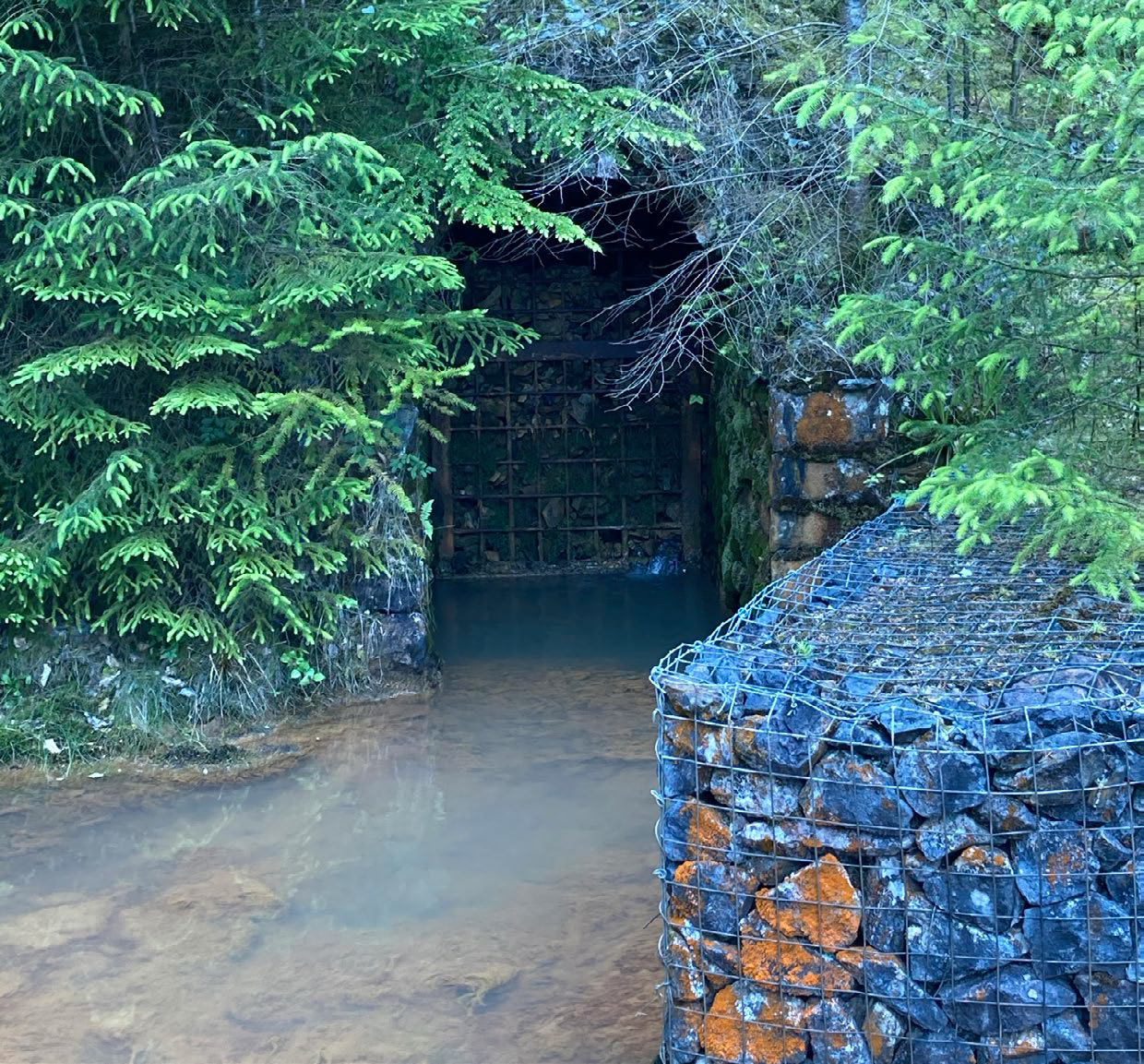
In 2011 Level No. 3 Adit collapsed close to its entrance, forcing water to exit the mine from the lower Level No. 4 Adit, via Kneebones Cutting which is a stope or open void.
A review of mining and mine water hydrology was undertaken in 2020, which indicated a low risk of sudden release of mine water from Level No. 3 and 4 Adits.
Like many former metal mine sites, Parc Mine has a number of ecological designations. The Adits and associated features are located in a Special Area of Conservation (SAC) for calaminarian grasslands and the lesser horseshoe bat and is also a Site of Special Scientific Interest (SSSI) for geological features, plant assemblages and bat hibernation sites.
Project Progress
Natural Resources Wales (NRW) and the Mining Remediation Authority (MRA) are working together on the Wales Metal Mines Programme to address this polluting legacy. The Programme is funded by Welsh Government.
Over the past few years we have been gathering information to better understand the pollution sources from Parc, and to identify potential remediation options.
In 2020 a review of mine water hydrology was undertaken which indicated a low risk of sudden release of mine water from Parc Adits 3 and 4. This review recommended additional work to improve our understanding of the mine system.
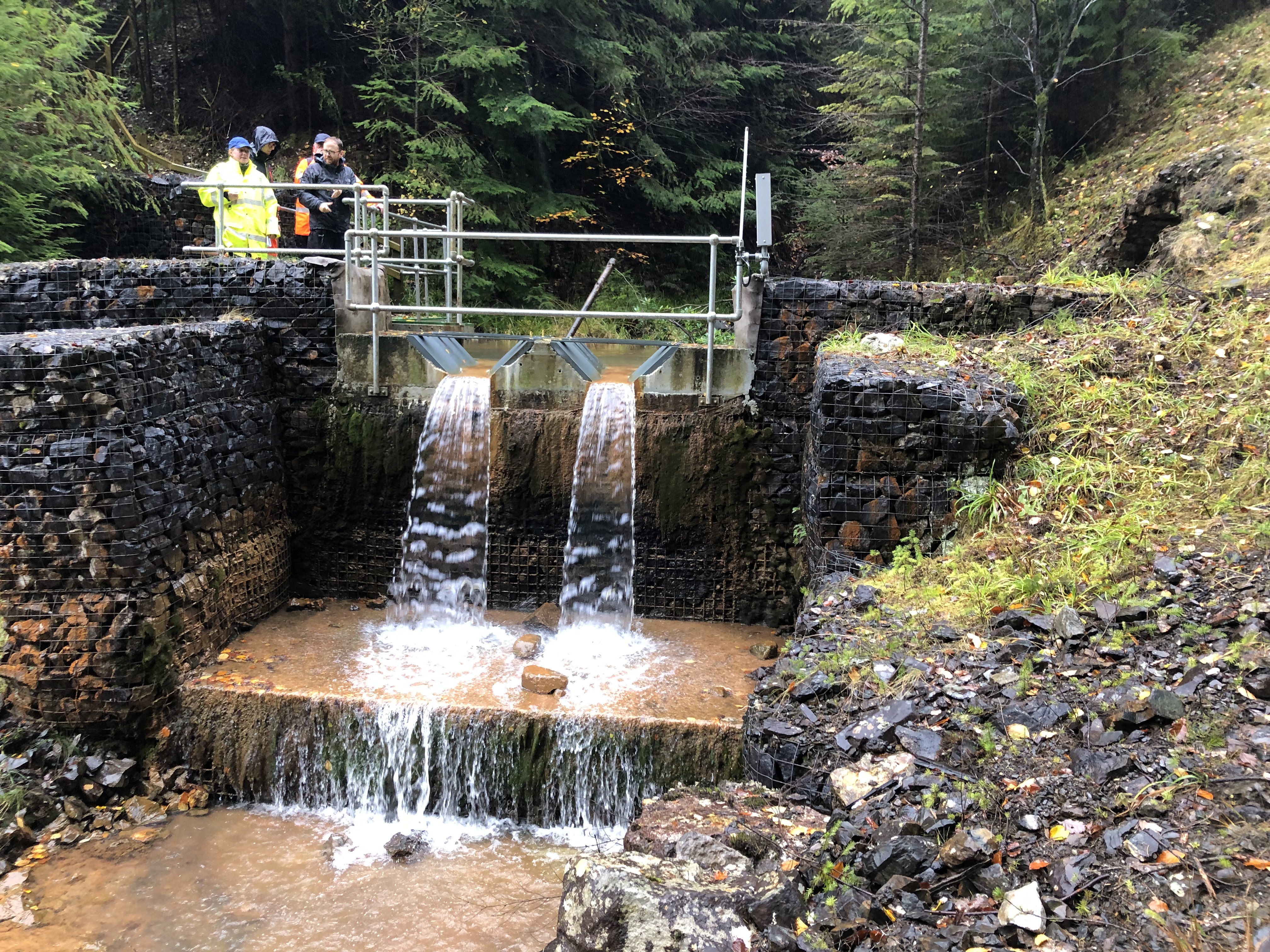
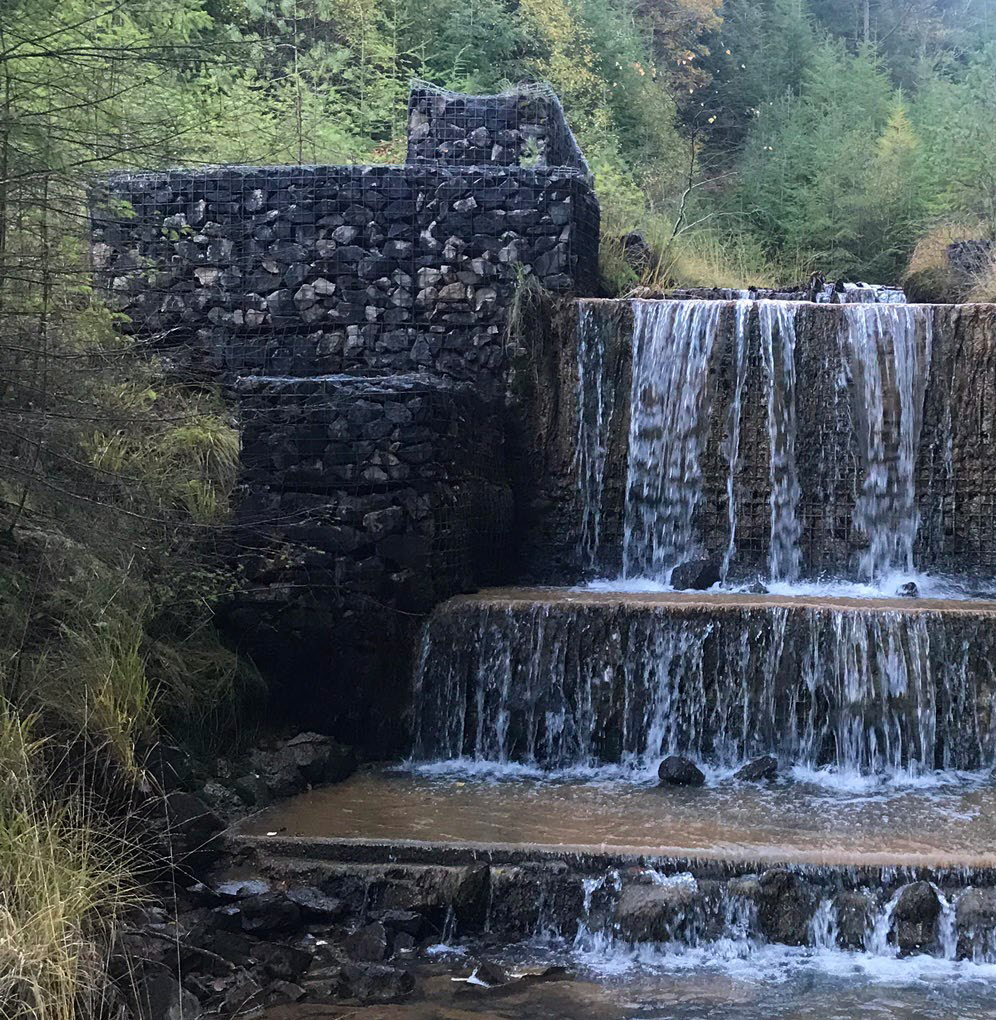
We subsequently installed flow monitoring structures on four adit discharges, three outflows from a reclaimed tip and on the outfall of the reservoir Llyn Fuches Las. We are continuing to monitor the water quality and flow at key locations around the mine.
We have completed archaeological and ecological assessments and commissioned a Scoping Study to identify a long list of possible mitigation options to improve the water quality in the Nant Gwydir and Afon Conwy.
It is likely that a combination of the high-level mitigation options presented below, will be needed to successfully manage the range of pollution sources at Parc.
We welcome your input as we continue to develop our options, and seek to identify opportunities for environmental, social and economic scheme enhancements.
Possible Mitigation Options
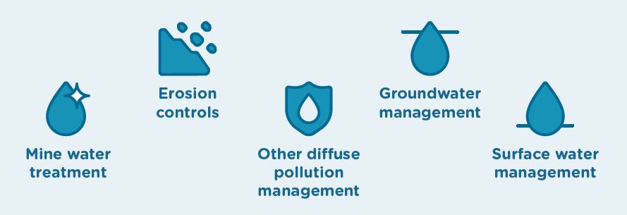
Possible Mitigation Options:
- Mine water treatment
- Erosion controls
- Other diffuse pollution management
- Groundwater management
- Surface water management
Next Steps
We will now undertake a Feasibility Study to assess the technical, environmental and economic suitability of the possible mitigation options. This will lead to a short list of feasible options from which a preferred remediation strategy for the site will be selected.
It is likely that this will be a phased strategy, targeting specific pollution sources over a number of years, allowing design, construction and then assessment of each intervention.
We would like the local community and other stakeholders to play a key part in this process. We will be holding public consultation events later in the project, and issuing further newsletters to communicate progress.
An indicative timeline is presented below, which is subject to securing the required funding.
Current Timeline
To date
Defining the problem: Baseline surveys and water quality monitoring to inform a Scoping Study and long list of mitigation options.
2025
Short list options: Feasibility Study to assess long list options and identify a suitable short list of possible mitigation options.
2026 Onwards
Preferred remediation strategy: Development of the preferred Remediation Strategy for the site with ranked mitigation options for further consultation.
Construction and assessment: Design and construction of the highest ranked mitigation option, followed by assessment of its impact on water quality.
Newsletters
Your browser does not support inline PDF viewing. Please download the PDF.
Reports / Information
Keeping in touch and how to get involved
We want to hear from you as we progress the Parc Mine Project and explore the wider environmental and social opportunities that can be developed as part of the preferred strategy for this site.
If you’d like to share your views, be added to an email mailing list, or have any questions please get in touch on the details below:
parc@metalmineswales.co.uk
Areas
- All Areas
Audiences
- Metal mines
Interests
- Metal mines
Share
Share on Twitter Share on Facebook