Ely Bridge Flood Risk Management Scheme
Overview
The River Ely flows from the foothills to the north of Llantrisant, through St Fagans, Ely and down to Cardiff Bay and then the Severn Estuary.
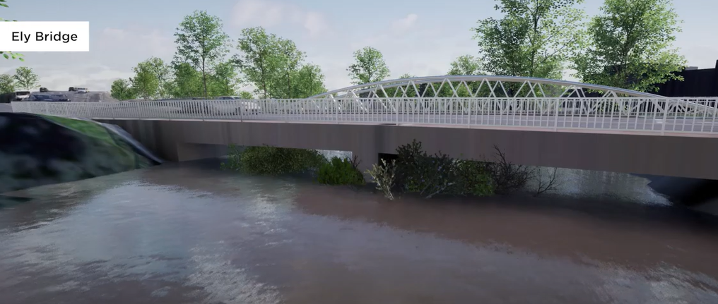
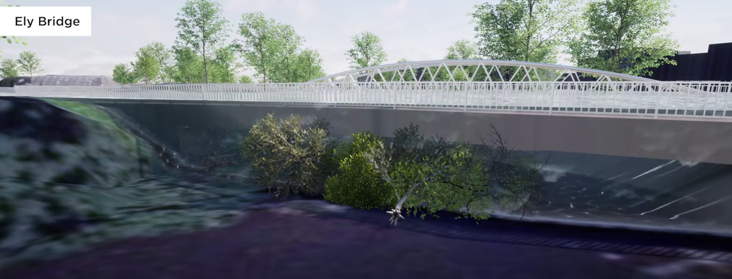
The river passes under Cowbridge Road West under the A48 bridge.
There has been a history of flooding in this area. In September 2008, some 27 properties were inundated. At its peak in 2008 river flows would fill an Olympic swimming pool every 20 seconds! More recently properties flooded in 2011, 2012 and 2020. Widespread flooding is recorded as far as Victoria Park in 1927 and 1960.
The A48 bridge is prone to blockages caused by debris getting trapped on the bridge pier in the middle of the river. Blockages reduce the capacity of the bridge and significantly increase flood risk to properties, and were contributors to the recent flooding. Debris accumulation cannot be safely removed at times of high flow.
This video shows an example of a large branch floating down the River Ely under the Cowbridge Road bridge.
The problem
Our recent studies have shown that flood risk increases significantly when Cowbridge Road bridge (A48) over the River Ely is partially blocked with debris, particularly trees and other large objects.
The bridge is particularly sensitive to blockages because of its skewed central pier and low clearance above the river.
Blockages reduce the capacity of the bridge. Furthermore, there is currently no safe way for our operatives to remove large blockages, particularly at times of high river flows.
As river levels rise, the low underside of the bridge traps debris below the water level, reducing the capacity for water to flow under the bridge.
If the bridge is kept clear, more water is able to pass beneath and downstream, reducing the risk of flooding to the surrounding area.
The risk
Currently, a 1 in 30 annual chance event with partial blockage at Ely Bridge leads to flooding of around 40 properties in the immediate vicinity.
A 1 in 50 annual chance event with partial blockage at Ely Bridge leads to flooding of more than 200 properties around the bridge and towards Victoria Park.
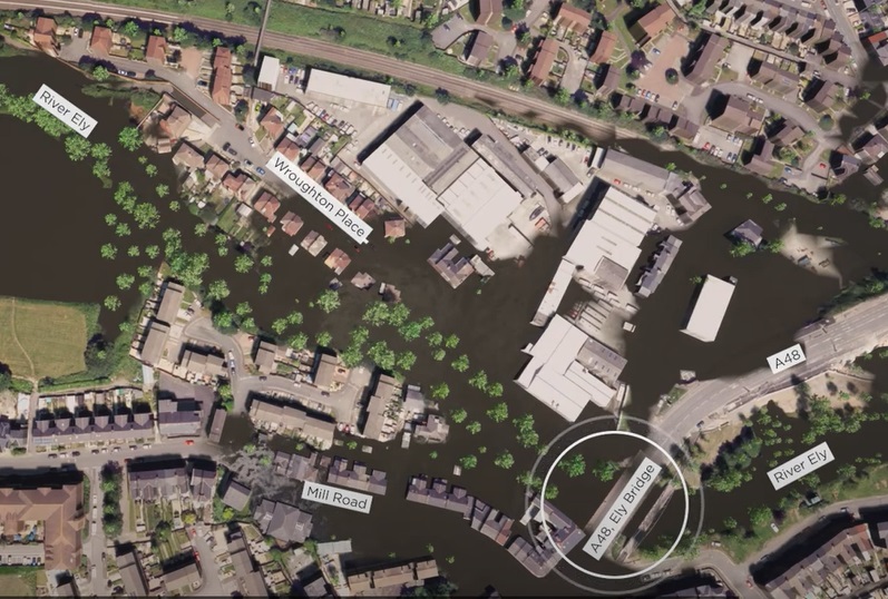
A 1 in 100 annual chance event with partial blockage at Ely Bridge leads to flooding of up to 500 properties across a wide area. The map below shows the flood extent during this event.
The options
We've undertaken several studies to comprehensively assess the case for flood risk management in the area. This has included the appraisal of:
- options to slow the flow upstream;
- containing flood levels with various forms of raised defences;
- measures to convey flooding through channel widening, and
- property flood resilience measures.
As part of the Ely Mill development, river channel widening and removal of the remnants of the Arjo Wiggins weir were completed by the developer in 2017, which reduced the existing upstream flood risk.
However, other measures appraised were found to be uneconomical and the blockage risk to Ely Bridge remains.
The solution
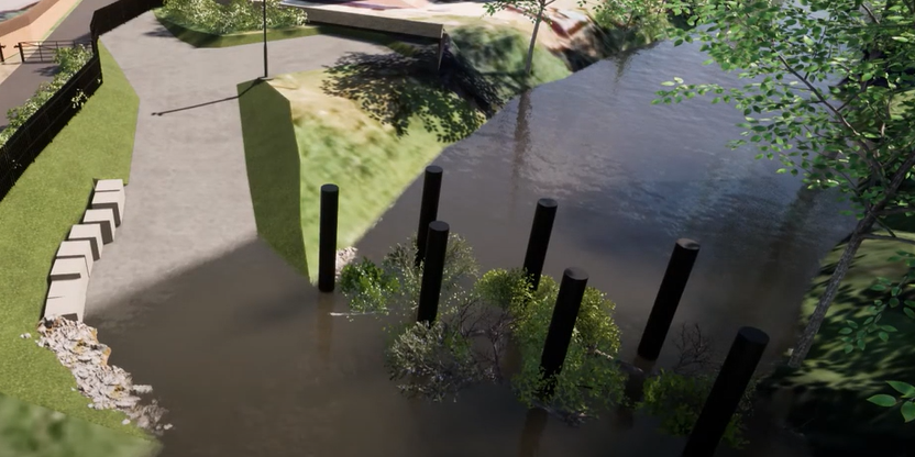
We will construct a tree catcher upstream of Wroughton Place to catch trees and other large debris before it reaches Ely Bridge.
We estimate about 490 properties will be protected during a 1 in 100 annual chance event with the tree catcher in place.
How does the tree catcher work?
The plan consist of seven poles in a staggered arrangement across the river, spaced widely to target large debris that would otherwise be trapped at the bridge.
As water levels rise during a flood event, debris trapped by the poles will float on the water surface, allowing water to pass beneath and continue downstream.
By trapping debris at a safe location upstream of Ely Bridge, the risk of flooding is reduced.
An access ramp and processing area will also be constructed to make it easier for our operatives to remove the blockages and cut them up for disposal. The build up of debris will be actively monitored using a CCTV camera.

This location was selected because of its proximity to the bridge, the existing access from the highway and to avoid the Ely Wells abstraction wells located in the riverside embankment further upstream.
The site will be secured with fencing, and planting will screen the site from the adjacent foot and cycle path.
The works
We are also undertaking works to improve the river access at Ely Bridge should maintenance be required there too.
Our contractor is currently working beside the Cowbridge Road bridge to install a secondary access ramp for the purposes of removing debris and undertaking future shoal management works.
This work will be completed in October 2020.
Our intention is to return in Spring 2021 to install the tree catcher to the north of Wroughton Place.
We will continue to contact residents throughout the duration of the works to keep them updated on progress and how we’re planning to minimise the inconvenience to both residents and people who use the local footpaths and amenities.
Areas
- Ely
- Fairwater
Audiences
- Flooding
Interests
- Flooding
Share
Share on Twitter Share on Facebook